Project Components

The FM Area Diversion consists of four major components, each having a specific purpose within the comprehensive project.
               
2021 Bubble Map Swdcai

Stormwater Diversion Channel

Delivered by: Red River Valley Alliance

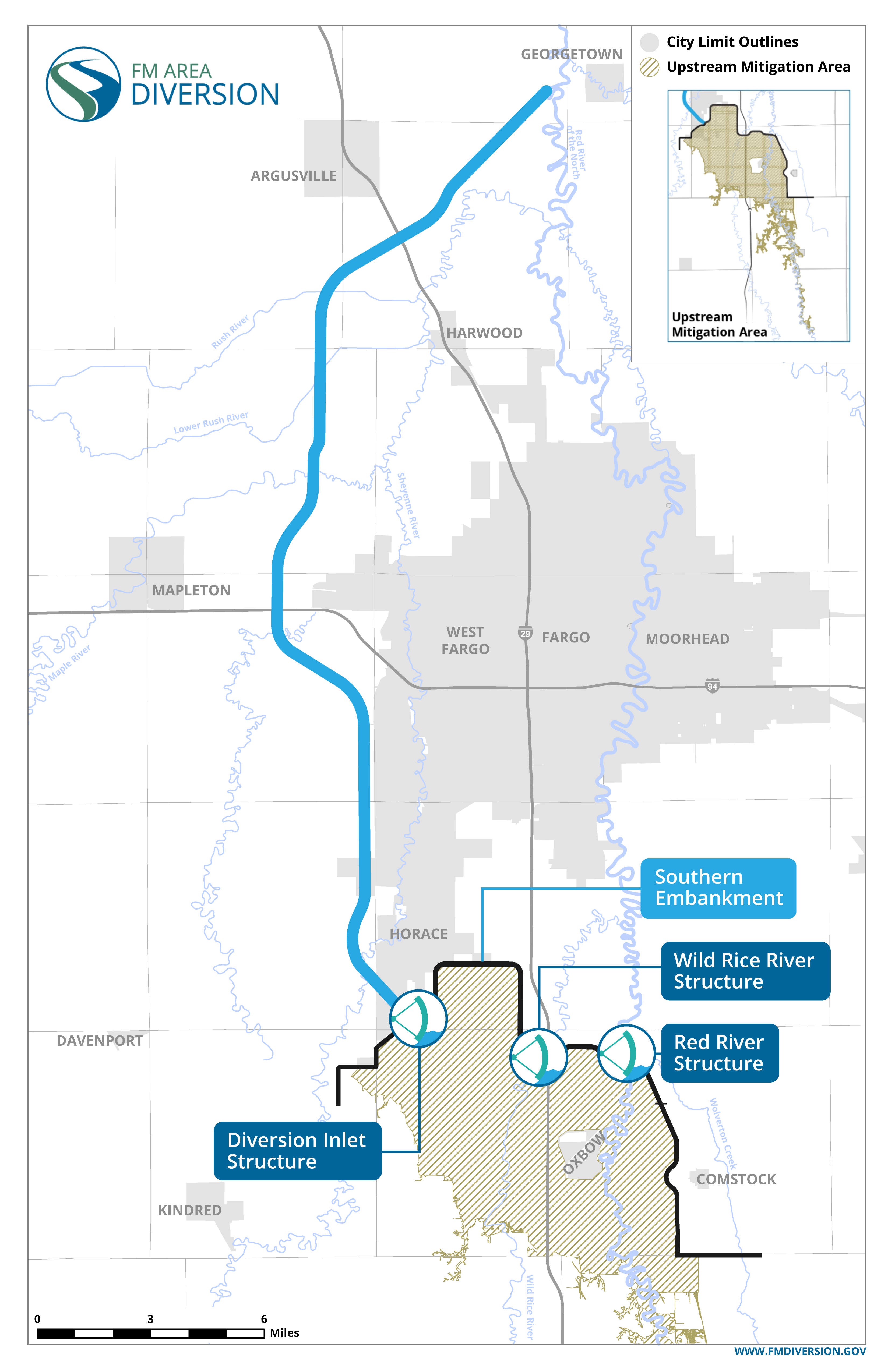
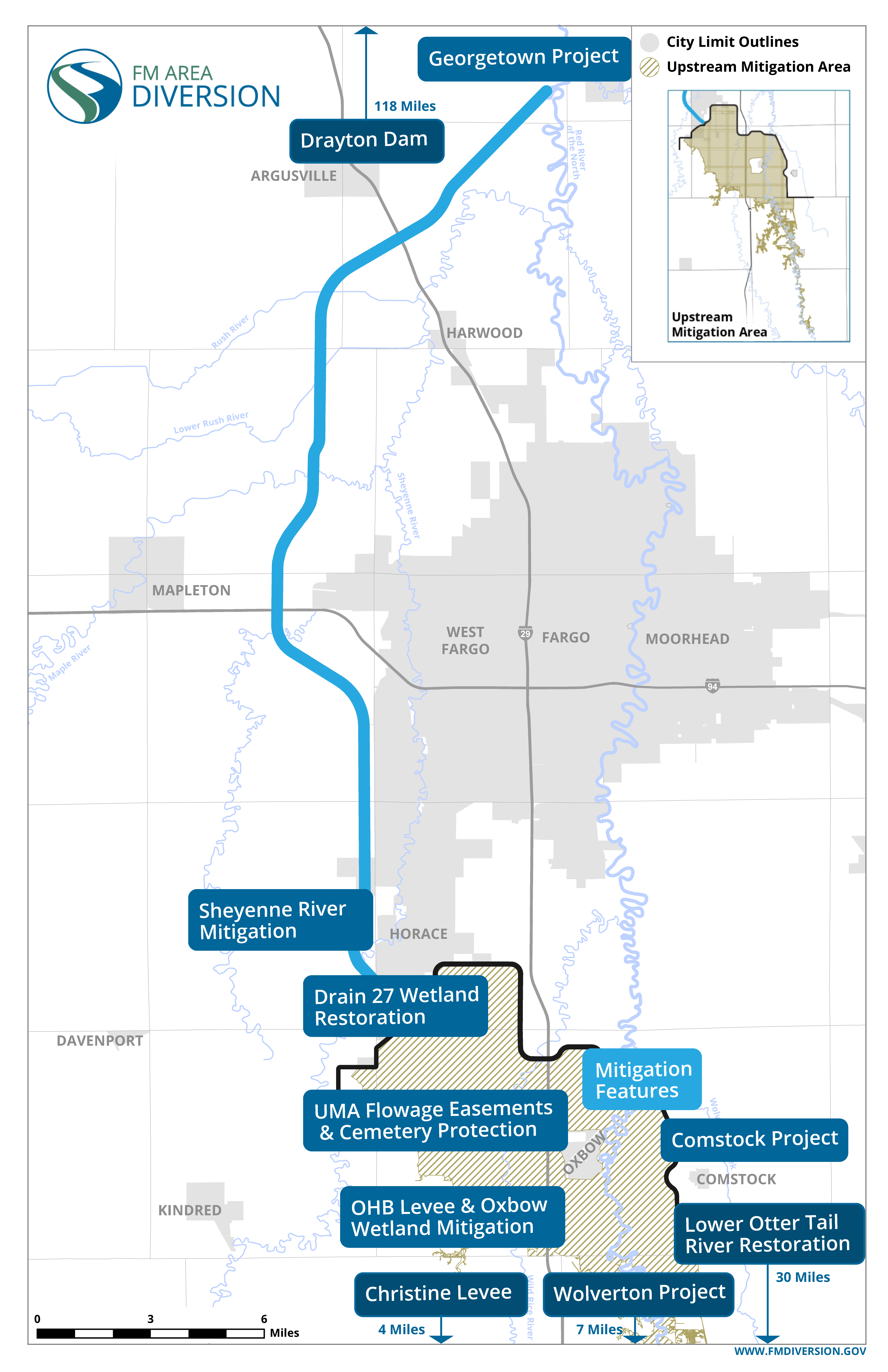
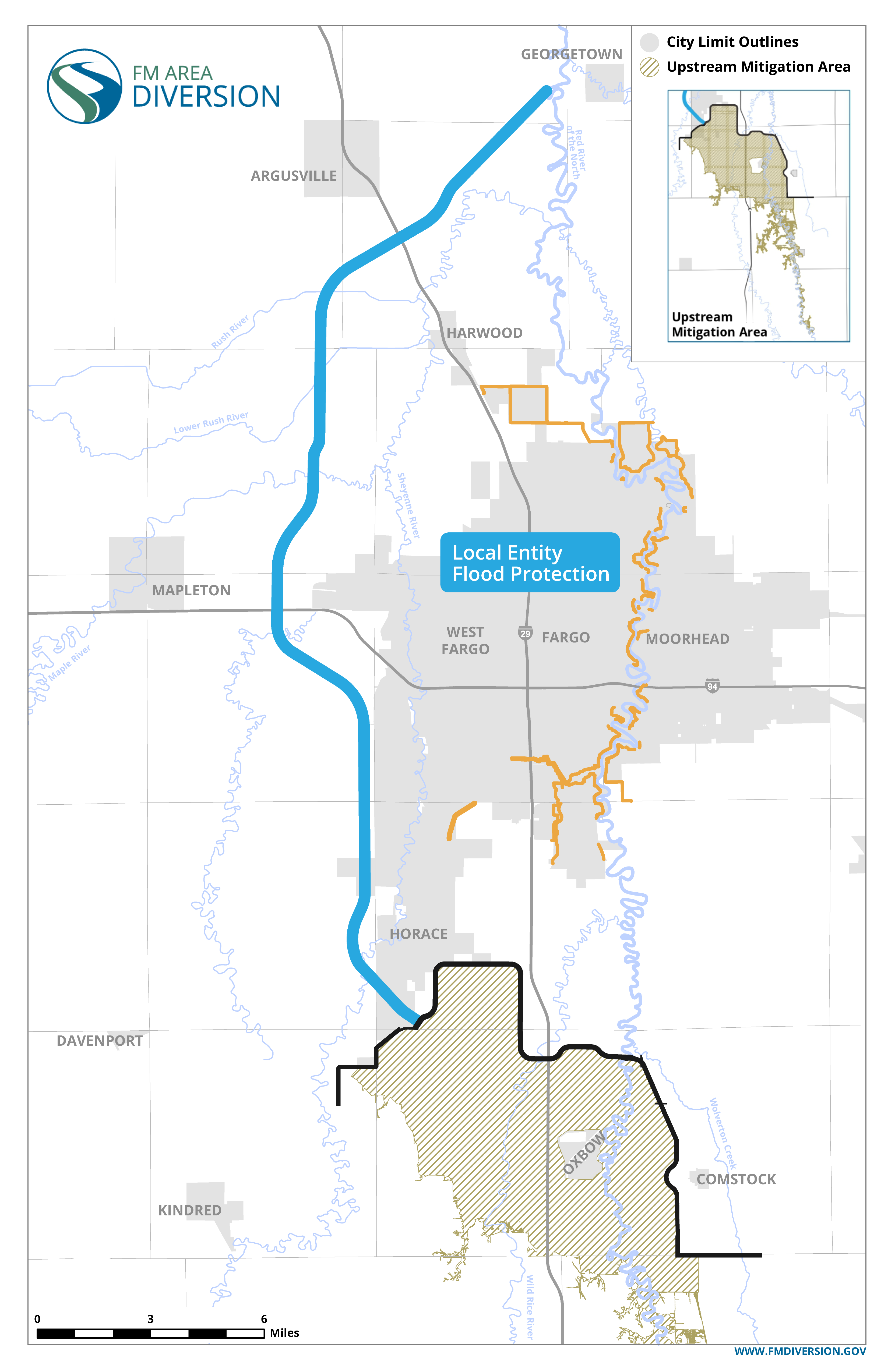
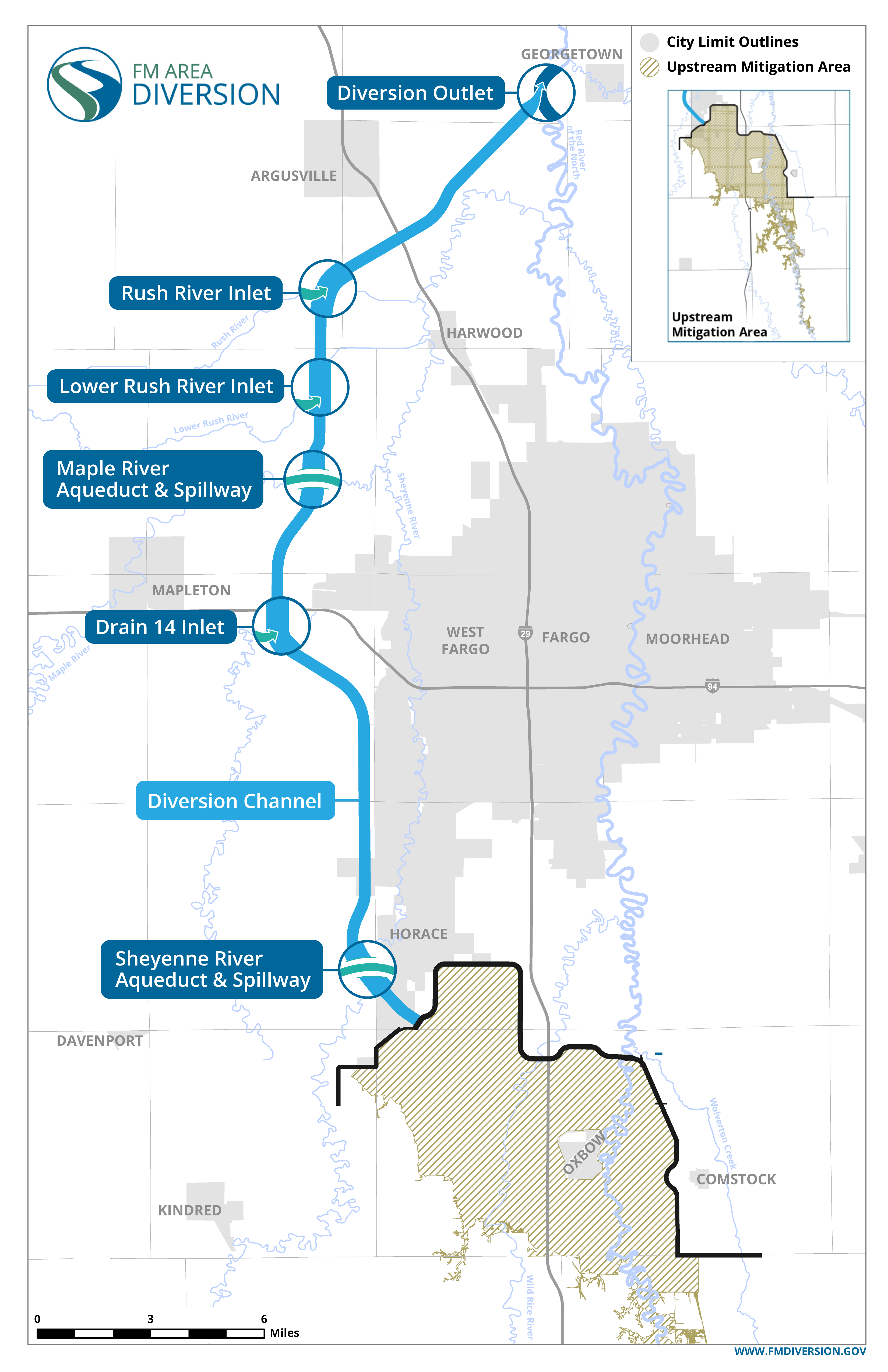
The Stormwater Diversion Channel and Associated Infrastructure (SWDCAI) includes a 30-mile stormwater diversion channel, a diversion outlet, and aqueducts on the Maple and Sheyenne Rivers.

There also will be:

  • Fourteen drainage inlets
  • Three railroad crossings
  • Two pairs of interstate crossings
  • Twelve county road crossings
               
2021 Bubble Map Seai

Southern Embankment

Delivered through: U.S. Army Corps of Engineers and contractors

The Southern Embankment and Associated Infrastructure (SEAI) includes a 22-mile earthen embankment and three gated control structures:

  1. Diversion Inlet Structure
  2. Wild Rice River Structure
  3. Red River Structure

Each structure will have large radial-arm gates that raise and lower during project operations to control flooding.

The SEAI also involves constructing several transportation features, including an I-29 bridge crossing and 4-mile grade raise and county and township road crossings.

               
2021 Bubble Map Mfai

Mitigation Projects

Delivered by: U.S. Army Corps of Engineers and the MFDA in partnership with city and county governments

The comprehensive project includes numerous mitigation features, including:

  • An upstream mitigation area, where flowage easements will be acquired, property/structures will be removed, and cemeteries will undergo mitigation to protect the property and viewshed
  • Levees in Oxbow-Hickson-Bakke and *Christine, North Dakota, and *Wolverton, Minnesota
  • Wetland mitigation projects in Oxbow and at Drain 27 in North Dakota
  • River restoration project on the Lower Otter Tail River
  • *Complementary flood-mitigation projects in Georgetown, Comstock and Wolverton, Minnesota

*Projects not delivered by the U.S. Army Corps of Engineers

The comprehensive project will follow an Adaptive Management and Monitoring Plan to monitor environmental mitigation project performance and any environmental changes after operations.

               
2021 Bubble Map Lfpai

In-Town Features

City and county governments are working on in-town protection measures. Also known as Local Entity Flood Protection & Associated Infrastructure (LFPAI), this includes:

  • Levees and floodwalls
  • Stormwater lift stations
  • Road improvements and grade raises

How It Will Work During Floods

Learn how each component will work during times of extreme flooding.

How It Will Work