FM Area Diversion Maps
Use these tools to get a better picture of the path the FM Area Diversion will take, where each of the components will be, and what land areas will be impacted.
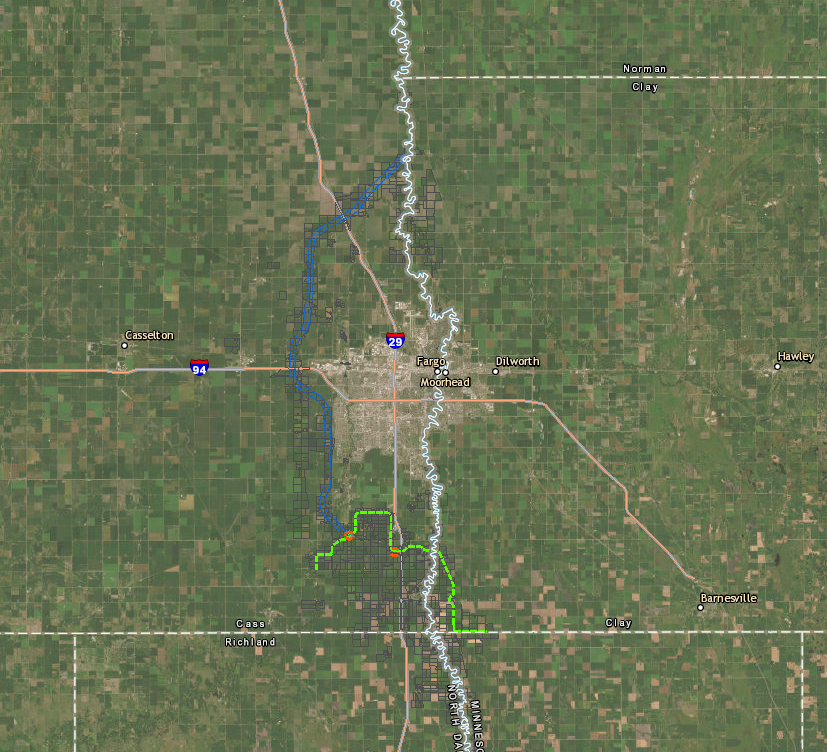
Interactive Lands Map
Use the interactive map to view the entire project, or zoom in on specific parcels by typing in an address or parcel number. Find further instructions on using the map below.
Floodplain Maps
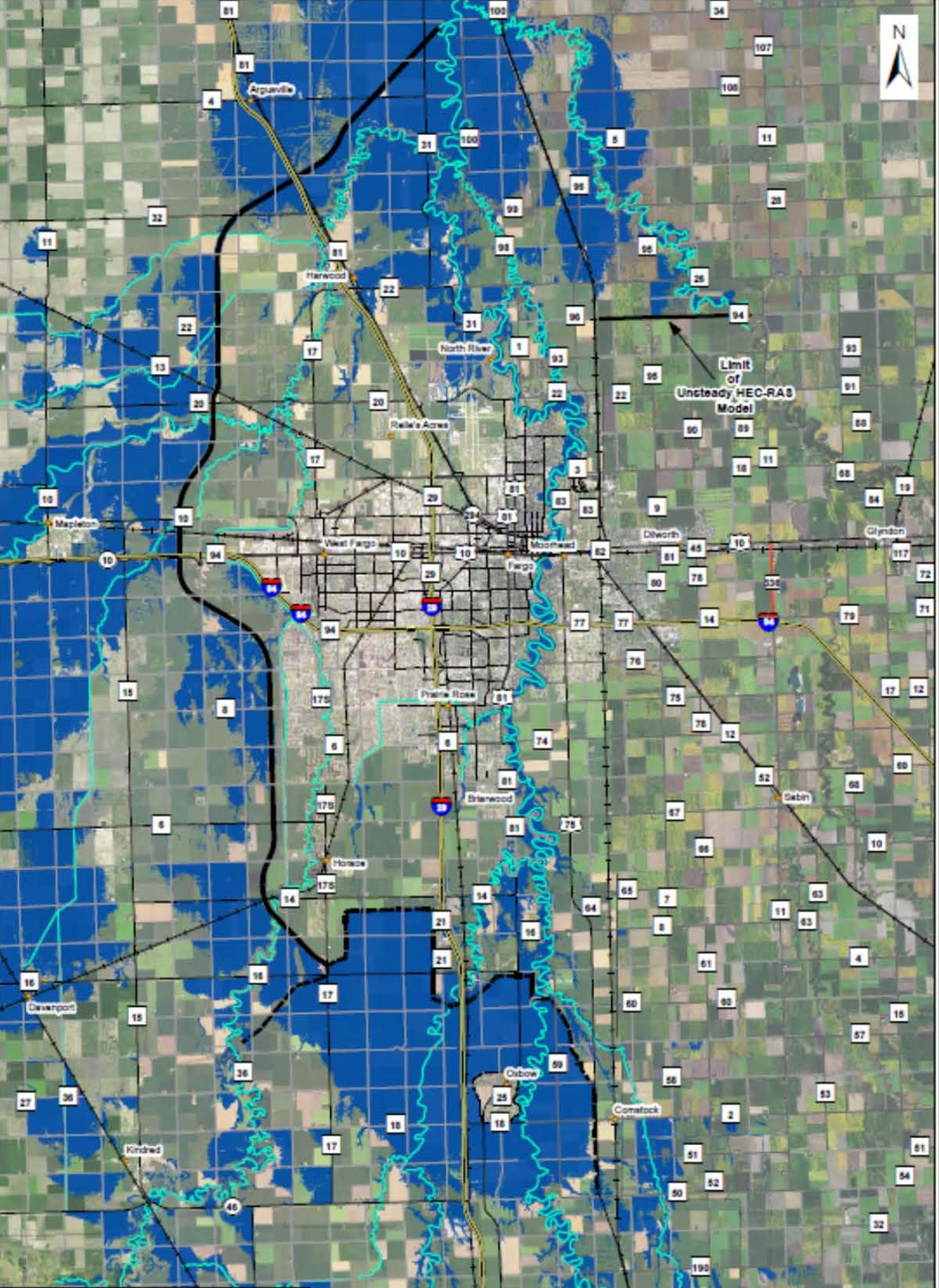
FEMA’s 100-year flood zones show areas of the U.S. that have a 1% or greater chance of flooding in any given year. Areas are broken down into more specific zones, as well. These floodplain maps are used to determine which landowners are required to buy flood insurance.
See our region mapped with FEMA’s 100-year flood zones and for FEMA’s estimates of how those zones will change after the project’s completion.
Sign Up for Our Monthly Newsletter
DISCLAIMER: By signing up, you agree to receive emails from MFDA. You can unsubscribe at any time.